• Project overview
  • BACKGROUND
  • Exhibit and Documents
  • Comments and Questions
  • More
    • Project overview
    • BACKGROUND
    • Exhibit and Documents
    • Comments and Questions
  • Project overview
  • BACKGROUND
  • Exhibit and Documents
  • Comments and Questions

Wagon Trail Project Phase II

Wagon Trail Project Phase IIWagon Trail Project Phase IIWagon Trail Project Phase II

Background

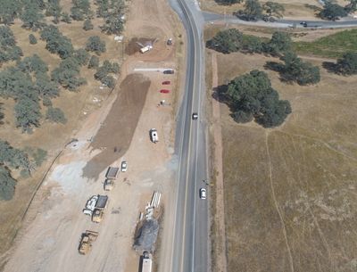
As a major east-west connector through southern Calaveras County, State Route 4 (SR 4) provides access from the San Joaquin Valley to the Sierra Nevada Mountains. Within the County, the two-lane highway traverses primarily rural farmland, characterized by a rolling terrain that supports rock outcroppings, seasonal streams, natural vegetation, and agricultural operations.


This project aims to transform 6.5 miles of highway in south Calaveras County, built atop an 1840s wagon trail, into a modern highway. Therefore, the last unimproved segment of highway between the Bay Area and Central Valley to western Sierra destinations will be improved within Calaveras County.

Additional Information

If you would like to see more information on Phase 1, please visit the following link:


https://www.wagontrailproject.com/


Project Partners

Contact Us

Please Submit Questions or Comments

This site is protected by reCAPTCHA and the Google Privacy Policy and Terms of Service apply.

If you have questions about the project, email us at info@wagontrailphase2.com


Copyright © 2023 Wagon Trail Realignment Project Phase 2 - All Rights Reserved.

Powered by GoDaddy

This website uses cookies.

We use cookies to analyze website traffic and optimize your website experience. By accepting our use of cookies, your data will be aggregated with all other user data.

Accept